Sights
Dream Trail stations
Sights
Dream Trail stations
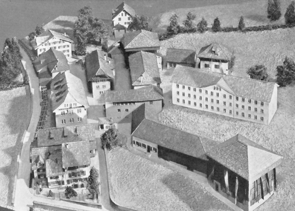
Station 1
Egidius Trümpy cotton mill
In the 19th century, the miserable working conditions in the textile factories in the canton of Glarus had a devastating impact on the health and social life of the working population. This incredible level hardship proved to be a breeding ground for reforms. In 1816, the first factory health insurance fund in Switzerland was founded by workers of the Egidius Trümpy textile printing works in the Bleiche Glarus. In 1837, workers at the same business went on strike for two weeks to prevent the introduction of a factory bell signalling the beginning and end of working hours.
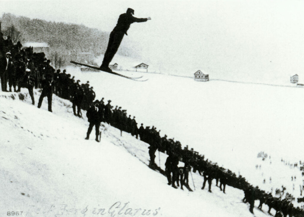
Station 3
Unter Sagg
On 28/29 February 1893, the first ski club in Switzerland, the Glarus Ski Club, was founded. The first ski race in Switzerland was held at Sackweiden in 1902. Various foreign newspapers had sent their special correspondents to this event, which was being followed by 400 people, including official representatives of the Glarus municipal council. Races across the Pragel and the Schwammhöhe to Glarus soon followed over the next few years. In 1905, the championships of the newly founded Swiss Ski Association took place here, with the ski jumping competition, watched by a crowd of around 10,000 spectators, attracting the most attention.
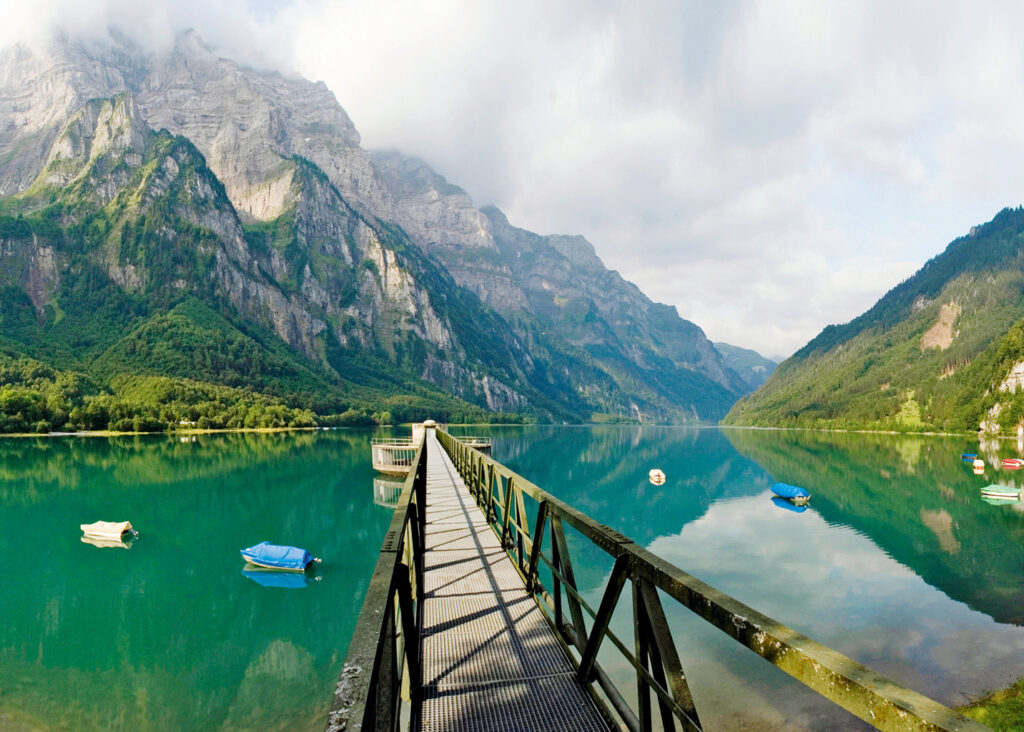
Station 9
Seerüti
It’s no wonder that this landscape was the original source of inspiration for modern alpine painting. It was the Zurich native Conrad Meyer who, by the shores of Lake Klöntal in 1655, produced the first exact and artistically ambitious alpine depictions, which were painted not only from afar, but from locations within the middle of the alpine mountains themselves as well. His legacy lived on through many painters, including a number of English ones – one of whom was Robert Cozens. The horizon appeared a sunset shade of reddish-yellow when he painted Lake Klöntal from different perspectives in the autumn of 1776. With his masterful, almost dreamlike watercolour technique, he captured air, light and shadow – the elements that lend a landscape its individual atmosphere, thus influencing renowned Romantic artists such as William Turner and others.
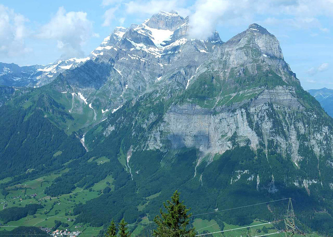
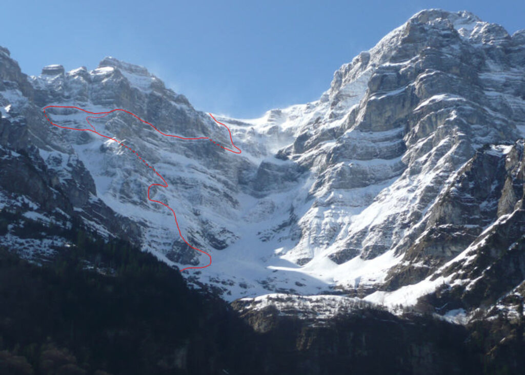
Station 13
Schwammhöhe – Glärnisch landslide heads
The view on a clear day is fittingly magnificent – stretching from the Tödi and encompassing the Bernese Alps, the Swiss Jura, the Vosges, the Black Forest, Lake Zurich, Lake Constance and further still into Austria. The Glärnisch consists of two main ridges, which enclose the Glärnischfirn (the ‘Glarnisch Glacier’) that runs off to the southwest. The Ruchen (2901 m) is the highest point of the northern ridge and the easiest summit to climb. Slightly higher is the southern ridge and the Bächistock (2914 m). Both ridges join at the Schwander Ridge, which forms the entrance to the Glärnisch’s most climbed peak, the Vrenelisgärtli (2904 m). In the summer of 2003, the Vrenelisgärtli’s distinctive névé completely melted for the first time in its recent history. The normal route leads from the western end of Lake Klöntal, through the Rossmatter Valley, and up to the Glärnischhütte (1990 m – an elevation gain of about 1100 metres) – a mountain hut where you can rest for the night and climb one or more of the three Glärnisch peaks the next day.
Station 15
Chalttäli
At this station, you are close to the many impressive layers of rock that, from a distance, look like stripes adorning the mountain. The layers are not always the same thickness and sometimes similar units are stacked on top of each other to form a geological nappe. On the Ruchen, you can see that four nappes have been thrust on top of one another. It’s hard to imagine that all of these limestone beds came into existence over 100 million years ago in a mild tropical sea.
Station 16
Fossil site
The fossils are assigned to the Helvetic Dogger (Middle Jurassic) and Malm (Schilt layers, Upper Jurassic), making them around 160 million years old. Many iron-bearing sandstones (iron oolites (blegioolite) are rich in belemnites and ammonites. The climatic conditions of this period were similar to those in the Caribbean today.
Station 18
On the Dam
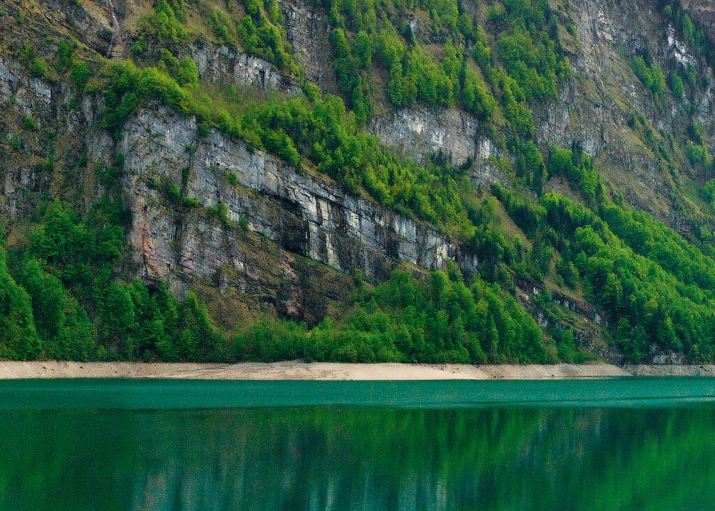
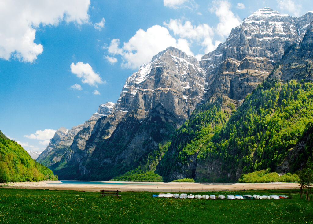
Still deafened by the noise of the stream, you climb the height of the reservoir dam and step in front of another world entirely – the lake. Speechless, stunned, still. And behind it, the Glärnisch, a tremendous obelisk erected by nature itself. It stands there, rigid and immovable, with its brow the only indication of the many storms it has defiantly weathered. Its mighty walls tower 2,000 metres above the lake. To look upon it is so overwhelming that you won’t be able to help but feel that you have never seen a true mountain before that moment. Between the Vrenelisgärtli and the walls of the Ruchen, the firn ice threatens to plunge from the Schwander Grat and down through Chalttäli into the depths below. How this almost vertical, sunless valley got its name – Chalttäli, or “Cold Valley” – will be most obvious to you in winter, when you are gliding across the glassy ice of the frozen lake from the Rhodannenberg to the far side of the Klöntal Valley. The already ice-cold air above the lake is cooled yet further around the valley opening as a result of a colder air current, to the point you will feel as though the blood in your veins is on the verge of freezing.
Station 20
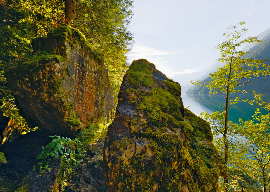
Gessner Memorial
The bridge over the Darlibach is where the dirt road stops and the footpath begins. After walking a short while, you will see the Gessner Memorial, a group of stones just a few metres above the path that nature is said to have built for Salomon Gessner, a painter and writer of idyll poetry from Zurich. It was dedicated to him by two admirers who, with tears in their eyes, flung their arms around each other’s necks and kissed at the inauguration of the memorial stone in 1788. Whether the memorial stone served more as a tribute to Gessner or as a way for these two to immortalise themselves remains to be seen. ‘Duo rudes, rudi saxo, rude monumentum posuere‘ – two people, rough around the edges, constructing a rough monument from rough stones was not something famous naturalist Oswald Heer found too inappropriate. A traveller from Potsdam put it simply when they said that what the Gessner Memorial lacks in gravitas, the Klöntal Valley itself makes up for a thousand times over. In any case, the Klöntal Valley received an unexpected boost in popularity with the publication of the history of the Gessner Memorial in 1789, and with the first depiction of the monument, a national pictorial subject was created that shaped people’s view of the ‘mountain valley with a lake’ for over a century. And that’s how art tourism essentially began in the Klöntal Valley.
Station 24
Dungellaui waterfall
Would you like to know what it truly feels like to have your breath taken away? Then treat yourself to a shower under the Dunggellaui waterfall. The tumbling deluge of water is, quite literally, breathtaking. An impressive experience in a unique rocky shower cabin with a magnificent view of the lake. PS: only recommended in very warm weather!
Station 38
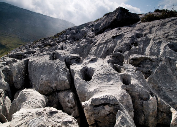
Dolines and karrenfields
Limestone rocks are impermeable, but are soluble if they come into contact with acids. When carbon dioxide comes into contact with rainwater, carbonic acid forms, which erodes and dissolves exposed limestone rocks. The rainwater and snowmelt flowing over the carbonate rock causes dissolution, especially along fine cracks and fissures. Through the cracks, the water seeps down and dissolves the lime further. This initially leads to shallow caves being formed, which eventually collapse and form conical seepage holes, better know as sinkholes or dolines. Over time, full-length cave systems develop and the course of the water moves further underground. That’s why you rarely see aboveground stretches of water in karrenfields. The largest known cave system in Europe that was formed this way is the Hölloch, below the karrenfields of Silbern. More than 200 km of this system has been explored so far.
Station 45
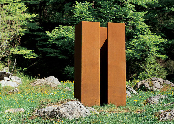
Richisauer Schwammhöhe – Le Manteau
‘Le manteau’, an almost two metre high steel sculpture that is situated on the Richisauer Schwammhöhe, was created by the Central Swiss sculptor Kurt Sigrist in 1994-95 and is the is the last work in the modern era that closes the circle on the blue bahia granite of Karl Prantl.
Station 47
Richisauer Schwammhöhe – a view of the wrong valley
Here in the Klöntal Valley, things aren’t as they should be. A tectonic unit, the Axendecke, broke apart and formed the Klöntal Valley. As a matter of fact, the two tectonic units known as the Axendecke and the Drusbergdecke meet between Twiren and Längeneggpass. So the Klöntal Valley should be where the Tälchen Chängel – Alp Unter Längenegg – Dejenalp is located today. But it didn’t follow the rules of nature, and so the left side of the valley, including Sulzberg, Mättlistock and Dejenstock, are, from a geological point of view, likewise part of the Axendecke of the Glärnisch. The Längeneggmulde, where the two architectural mountain units separate, was supposed to form part of the Klöntal Valley. As you can see, even geology doesn’t always play by the rules.
@Johannes Schindler
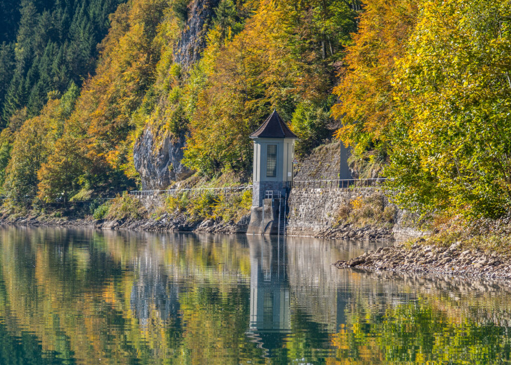
Station 49
The water castle
Commissioning took place on 1 July 1908. After more than 60 years in operation, the Löntsch power plant was rebuilt from 1971 to 1982. A part of the pressure tunnel, the surge tank, pressure shaft and pressure lines were reconstructed. more info